Collection:
Juneau—Douglas City Museum
Object ID:
2004.58.014 A—J
Accession#:
2004.58
Credit Line:
Donated by Brian Wallace.
Object Name:
Print, Photographic
Title:
Photograph album of tideland fill, circa 1940
Photographer:
Wallace, Amos
Place:
Juneau
Date:
11/01/1940
Description:
A is album page. B—J are black and white photographs. All photos horizontally oriented unless otherwise noted.
A — Black paper album page with two holes per side. Five photos affixed to front; four photos affixed to back. Captions printed in white ink beside photos to which they refer. "Paul" printed in white ink, lower proper right corner of front side.
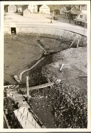
B — Photograph (4.75 inches by 3.5 inches), vertical orientation. Overhead shot of tidal flats at low tide. Willoughby Avenue (at south curve) cuts across top of photo, with Village houses visible beyond. Ground on far side of Willoughby is raised and leveled with rock fill. Truck parked on rock fill; person walking along road in direction of proper right. Barge and two small skiffs "high and dry" in foreground. Culvert under Willoughby in upper proper right quadrant. Caption under photo reads "Sewer Outlet".
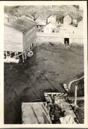
C — Photograph (4.75 inches by 3.5 inches), vertical orientation. Similar view to B but shifted further to proper right. Culvert still visible but closer to proper left edge of photo; rear/side of Alaska Native Brotherhood Hall now at proper right edge. Willoughby Avenue crosses photo horizontally approximately 1 inch from top of image, with tidal flats in foreground and houses/rock fill in background. Person walking along road (almost directly above culvert, slightly to proper left). Caption below photo reads "ANB Hall".
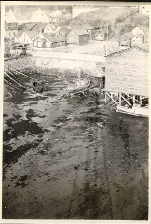
D — Photograph (4.75 inches by 3.5 inches), vertical orientation. Similar view to C but shifted further to proper right. Rear of Alaska Native Brotherhood Hall now at proper left edge with boat next to it on tidal flats. Village houses on far side of Willoughby Avenue from photographer, with hillside visible in background; house closest to road is dark with white windows and entryway built onto front. Caption below photo reads "Gridiron".
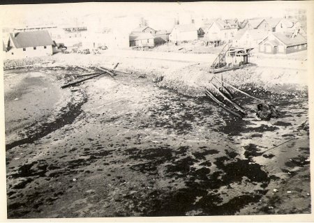
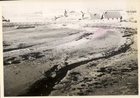
E — Photograph (4.75 inches by 3.5 inches), similar view to D but shifted further to proper right; dark house with white windows from previous photo now at proper left edge of image. Expanse of tidal flats in foreground with several logs/poles lying grouped near road. Willoughby Avenue with Village houses behind it in background. White building in upper proper right corner is Salvation Army. Caption below photo and extending under next photo reads "Tide—Flats — Counterclockwise".
F — Photograph (4.75 inches by 3.5 inches), similar view to E but shifted further to proper right. Expanse of tidal flats with road, rock fill, and Village buildings visible in background, along top of photo. Salvation Army building (white with larger structure in front and smaller one attached to back) now in upper proper left quadrant. See E for caption.
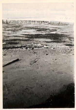
G — Photograph (4.75 inches by 3.5 inches), vertical orientation. Expanse of tidal flats with long federal dock crossing picture horizontally approximately 0.75 inches from top. Side view of long building (probably Standard Oil Company) adjacent to dock in upper proper left corner; "JUNEAU" printed in dark letters across roof. Caption to proper left of photo reads "S.O.Co."
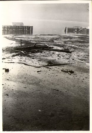
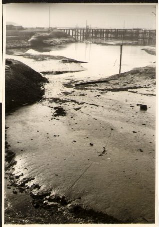
H — Photograph (4.5 inches by 3 inches), vertical orientation. Expanse of tidal flats with pile of long poles/debris near center of photo. Water in background with two docks extending horizontally from edges of photo, one at proper right, one at proper left. Dock at proper right has long light—colored building on it.
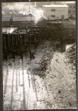
I — Photograph (4.5 inches by 3.25 inches), vertical orientation, borders trimmed. Tidal flats in foreground, wood pilings in mid—ground, buildings beyond. Shadows of pilings visible on ground extending toward photographer. Several Village houses in background, as well as flat—roofed light—colored building in upper proper left corner. Caption above photo reads "Dept. Agriculture".
J — Photograph (4.5 inches by 3.25 inches), vertical orientation, borders trimmed. Expanse of tidal flats in foreground, water covers much of ground in top third of photo. Dock crosses photo horizontally in background, approximately 0.5 inches from top edge; building visible at upper proper right edge on bluff. Caption above photo reads "Federal Dock".
Notes:
B — As per Marie Olson, third house (approximately) from proper left in upper corner (medium—dark colored, partially obscured by corner of school building, with shadow on roof) was where John and Ray Wilson lived as children. Building on far proper left edge of upper corner(light—colored with two large display windows) was Thibodeau's store.
People:
Wallace, Amos
Wallace, Brian
Wilson, John
Wilson, Ray
Thibodeau
Wallace, Brian
Wilson, John
Wilson, Ray
Thibodeau
Search Terms:
ANB
Architecture
Archival
Auke
Business
Cityscape
Ethnographic
Federal
Government
Landscape
Native
Oil
Organization
Photograph
Taku
Tlingit
Transportation
Architecture
Archival
Auke
Business
Cityscape
Ethnographic
Federal
Government
Landscape
Native
Oil
Organization
Photograph
Taku
Tlingit
Transportation
