Collection:
Juneau—Douglas City Museum
Object ID:
2005.27.001
Accession#:
2005.27
Credit Line:
Donated by Joel Orelove.
Object Name:
Map, photo
Title:
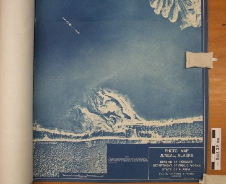
Large Blue Photo Map of Juneau, Alaska 1961
Place:
Gastineau Channel
Date:
06/08/1961
Description:
Large blue (blueprint?) photo map of Juneau and West Juneau with Gastineau Channel across center. Image extends from Rock Dump on one end to approximate area where Old Glacier Highway currently meets Egan Highway (Egan does not exist yet on this map.) In lower proper left corner, "This photo map has been prepared by Wyller, Van Doren & Hazard of Topeka, Kansas and Juneau, Alaska from photographs taken at an altitude of 4800 feet by General Aerial Surveys of Tulsa Oklahoma on June 8, 1961."
DIVISION OF HIGHWAYS
DEPARTMENT OF PUBLIC WORKS
STATE OF ALASKA
DIVISION OF HIGHWAYS
DEPARTMENT OF PUBLIC WORKS
STATE OF ALASKA
Notes:
Joel got this from the regional DOT office around 1980.
People:
Orelove, Joel
Search Terms:
transportation
road
map
Juneau
Photograph
Cityscape
road
map
Juneau
Photograph
Cityscape
