Collection:
Juneau—Douglas City Museum
Object ID:
2006.11.265A—B
Accession#:
2006.11
Credit Line:
Donated by the Caroline Jensen Estate.
Object Name:
Album Page, Photographic
Title:
Aerial view of Gastineau Channel and Glacier Highway
Place:
Juneau
Year Range from:
1940
Year Range to:
1965
Description:
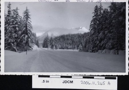
A. Black and white photos in horizontal view. Snow covered road lined with conifers. Mountain ridge fill background in mid photo. Upper picture margin has stamped " APR 65". Hand written in black ink in upper margin: "Winter 65 Mile 24 Gl. Hwy." On reverse side handwritten in blue ink: lower proper right "Glacier Hwy at Mile 24" and lower proper left "1965".
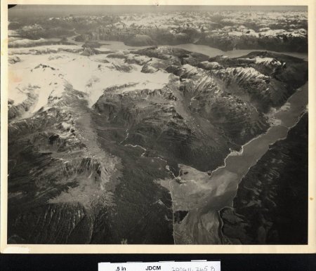
B. Aerial photograph of Juneau, Gastineau Channel, and Taku inlet. Lemon Creek Valley is visible in mid photo. Downtown Juneau is in mid photo proper left. Salmon Creek reservoir is visible mid photo proper left. Snow covered mountains fill background and upper proper right. A road is visible along the shoreline from downtown Juneau through Lemon Creek. A bridge is visible from Juneau to Douglas Island mid proper left.
B. Aerial photograph of Juneau, Gastineau Channel, and Taku inlet. Lemon Creek Valley is visible in mid photo. Downtown Juneau is in mid photo proper left. Salmon Creek reservoir is visible mid photo proper left. Snow covered mountains fill background and upper proper right. A road is visible along the shoreline from downtown Juneau through Lemon Creek. A bridge is visible from Juneau to Douglas Island mid proper left.
Search Terms:
Aerial
Mountains
Taku Inlet
Road
River
Juneau
Glacier
Icefield
Mountains
Taku Inlet
Road
River
Juneau
Glacier
Icefield

