Collection:
Juneau—Douglas City Museum
Object ID:
2004.58.012 A—H
Accession#:
2004.58
Credit Line:
Donated by Brian Wallace.
Object Name:
Print, Photographic
Title:
Photograph album of tideland fill, circa 1940
Photographer:
Wallace, Amos
Place:
Juneau
Date:
11/01/1940
Description:
A is album page. B—H are black and white photographs. All photos horizontally oriented unless otherwise noted.
A — Black paper album page with two holes per side. Three photos affixed to front; four photos affixed to back. Captions printed in white ink beside photos to which they refer. "Paul" printed in white ink, lower proper right corner of front.
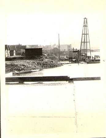
B — Photograph (4 inches by 3 inches), vertical orientation. View of Cropley Pile Driver (upper proper left quadrant) at water's edge at high tide. Houses and machinery in background; slope of rock fill extending into the water from proper right edge of photo. Upper third of photo is sky, with mountains very faintly visible; lower third of photo is flat land (paved? difficult to tell due to fading) with low wooden border. Caption to proper right of photo reads "South of Willoughby Avenue". Caption below photo reads "Cropley Pile Driver at Anchorage".
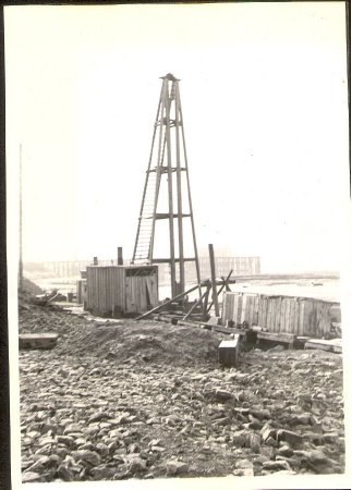
C — Photograph (4.75 inches x 3.5 inches), vertical orientation. Closer view of Cropley Pile Driver with rocky beach in foreground and wharf in background along horizon, approximately halfway between top and bottom of photo.
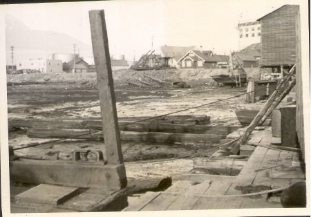
D — Photograph (4.75 inches by 3.5 inches), tidal flatlands with several logs lying across beach. Willoughby Avenue on ridge in background; crosses photo left to right. Village buildings visible along Willoughby with large oil tank in upper proper right quadrant. Platforms, boards, and some equipment in foreground. Large building on pilings in upper proper left corner. Douglas mountains faintly visible in background. Caption above photo reads "Low tide".
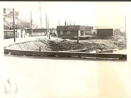
E — Photograph (4.25 inches by 3 inches), part of Willoughby Avenue (along bottom half of photo) turning west into the Village on proper right side of photo. Buildings along either side of road after it turns; some buildings also visible on hillside in upper proper right corner. Rock fill sloping downward from road to proper left of photo. Small panel truck parked on road in background, next to dark—colored house. Caption below photo reads "Willoughby turns West."
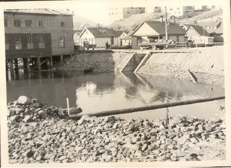
F — Photograph (4.25 inches by 3 inches), rocks in foreground with body of water beyond; road (Willoughby Avenue) runs along bank in background with steep dirt slope down to water. Large culvert visible in bank. Side view of old Alaska Native Brotherhood Hall on pilings in upper proper right corner; more buildings on side of road farthest from photographer, with several vehicles on street. Caption below photo reads "1st Culvert".
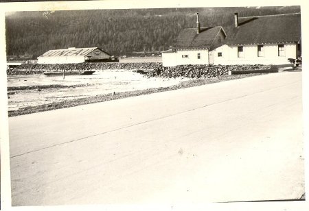
G — Photograph (4.25 inches by 3 inches), Willoughby Avenue occupies entire lower half of photo, running diagonally from lower proper right toward upper proper left corners. Salvation Army building next to road in upper proper left corner with rock fill under it. Beyond Salvation Army, to proper right of photo, is a long wide building with "JUNEAU" printed in large dark letters across roof. Caption below photo to proper right reads "S.O.Co." (Standard Oil Company?) and caption below photo to proper left reads "Salvation Army".
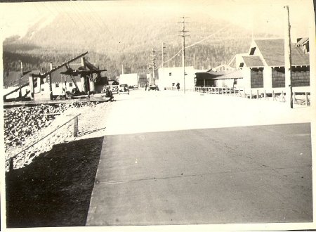
H — Photograph (4 inches by 3 inches), view of Willoughby Avenue running straight away from photographer toward Douglas Island. Salvation Army building on proper right partially obscured by construction equipment. Several Village houses on proper left side of road; some cars on road. Large shadow across road in bottom half of photo. Douglas mountains visible in background.
Notes:
As per Marie Olson, Cropley Pile Driver = Jake Cropley.
D — As per Marie Olson, one of the buildings (light—colored with flat roof at proper right edge) is Malaspina. Marie says there were many different kinds of clams in the tidal area there early on, but later it was too polluted.
D — As per Marie Olson, one of the buildings (light—colored with flat roof at proper right edge) is Malaspina. Marie says there were many different kinds of clams in the tidal area there early on, but later it was too polluted.
People:
Wallace, Brian
Wallace, Amos
Cropley, Jake
Wallace, Amos
Cropley, Jake
Search Terms:
Architecture
Archival
Auke
Cityscape
Ethnographic
Landscape
Native
Photograph
Tlingit
Transportation
T&E
Business
Oil
Archival
Auke
Cityscape
Ethnographic
Landscape
Native
Photograph
Tlingit
Transportation
T&E
Business
Oil
