Collection:
Juneau—Douglas City Museum
Object ID:
94.47.008
Accession#:
94.47
Credit Line:
Donated by David Kenway.
Object Name:
Map
Title:
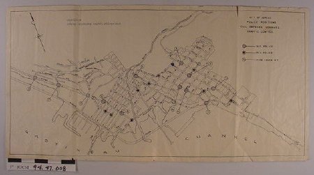
Juneau Police Positions for Civil Defense Traffic Control Map
Creator:
Miner Publishing Co., Juneau, AK
Date:
1/1/1945 0:00:00
Scope & Content:
Map of downtown Juneau before Egan Drive was developed and after old Douglas Bridge. Identified on map are street names and locations for: auxiliary and regular police and fire truck W.T. Also shown are arrows indicating routes directing flow of traffic to Valley. Map was "COURTESY OF / JUNEAU INSURANCE AGENTS ASSOCIATION"
Material: Paper/Ink
Material: Paper/Ink
Dates of Creation:
1/1/1945 0:00:00
Notes:
Used by Jenne family & preserved by Kenway family
Search Terms:
Government
City
Civil Defense
Military
Road
WW2
City
Civil Defense
Military
Road
WW2

