Collection:
Juneau—Douglas City Museum
Object ID:
2013.08.001
Accession#:
2013.08
Credit Line:
Donated by Mildred Goss Jones.
Object Name:
Map
Title:
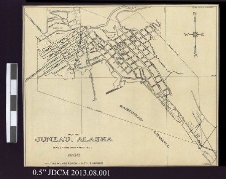
1938 Juneau Alaska Street Map
Creator:
Lagergren, Milton A.
Date:
1938
Scope & Content:
1938 Juneau, Alaska city street map drawn by Milton A. Lagergren, City Engineer. Map shows grid line of city limits. Lower proper right corner: "MAP OF \ JUNEAU, ALASKA \ SCALE ~ ONE INCH = 600 FEET \1938 \ MILTON A. LAGERGREN �CITY ENGINEER.Compass with the four cardinal directions is located in the upper proper left corner. Map shows one horizontal latitude line of 58 degrees 18 feet (58* 18') and two vertical longitude lines at 134 degrees and 25 feet (134* 25') and 134 degrees and 24 feet (134* 24'). Streets and locations are labeled.
Verso is blank.
Verso is blank.
Dates of Creation:
1938
People:
Lagergren, Milton A.
Search Terms:
Map
Road
Juneau
Road
Juneau
