Collection:
Juneau—Douglas City Museum
Object ID:
2003.05.001
Accession#:
2003.05
Credit Line:
Donated by Mary Ann Parke.
Object Name:
Chart, Navigation
Title:
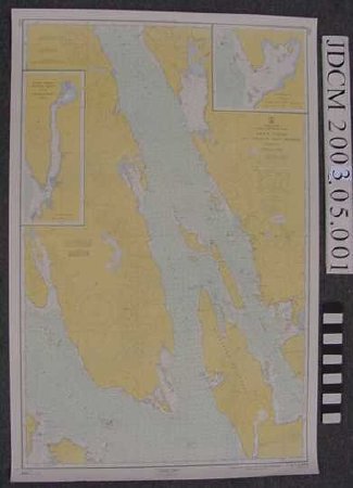
USC&GS Navigation Chart 8302 Lynn Canal, Icy Strait to Point Sherman
Creator:
U.S. Department of Commerce, Coast & Geodetic Survey
Date:
1960
Scope & Content:
US Coast and Geodetic Navigation Chart 8302 of "United States / Alaska — Southeast Coast / Lynn Canal / Icy Strait to Point Sherman". Mercator projection. Scale 1:80,000 at Lat 8 degrees 12'. Inset map of Funter Bay at scale 1:20,000. Inset map of Hawk Inlet at scale 1:40,000. Chart printed on heavy white stock. Yellow, green and blue colors with black and magenta print. In proper right lower corner "9th Ed., Dec. 23 / 63 / 8302 PRICE 75 CENTS"
Material: Paper/Ink
Material: Paper/Ink
Dates of Creation:
1/1/1960
Notes:
Charts used by Thomas S. Parke, father of donor. Parke operated C/V Barbarra V & later C/V Tiller Tramp from 1967 until his death in 1985. Vessels were used for "Coastwise Trade" which is US Coast Guard vessel use classification. In Parke's case this meant use for sports hunting & fishing, sightseeing, freight transport & specific project charters. Boats were also used for family outings.
Search Terms:
Map
Fisheries
Recreation
Fishing
Transportation
Maritime
Boat
Communication
Fisheries
Recreation
Fishing
Transportation
Maritime
Boat
Communication
