Collection:
Juneau—Douglas City Museum
Object ID:
2009.07.018
Accession#:
2009.07
Credit Line:
Donated by Jim Geraghty.
Object Name:
Map
Title:
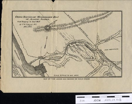
Map of Tide Lands and Basins on Gold Creek
Date:
December 1897
Scope & Content:
Cross Section of Mineralized Belt at Juneau, Alaska
From "Hanging" to Foot—Wall.
by G. W. Garside M. E. Decr. 1897
Map of tide lands and basins on Gold Street.
A map of the ore body from Gastineau Channel to upper Granite Creek at Juneau, Alaska.
From "Hanging" to Foot—Wall.
by G. W. Garside M. E. Decr. 1897
Map of tide lands and basins on Gold Street.
A map of the ore body from Gastineau Channel to upper Granite Creek at Juneau, Alaska.
Notes:
Map of Tide Lands and Basins on Gold Creek
People:
Geraghty, Jim
Garside, G.W.
Garside, G.W.
Search Terms:
Mining
Juneau
Map
Last Chance Basin
Gold Creek
Surveying
Mining
AJ
Boston Mine
Milwaukee Mill
Geological
Juneau
Map
Last Chance Basin
Gold Creek
Surveying
Mining
AJ
Boston Mine
Milwaukee Mill
Geological
