Collection:
Juneau—Douglas City Museum
Object ID:
2015.31.001
Accession#:
2015.31
Credit Line:
Donated by Constance Munro.
Object Name:
Map
Title:
1971 Juneau Illustrated Map
Creator:
Rudy J. Ripley
Date:
1971
Year Range from:
1971
Year Range to:
1971
Scope & Content:
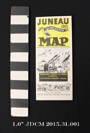
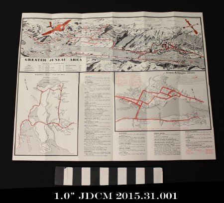
One illustrated fold out map of Juneau, including downtown, Mendenhall Valley and Douglas Island. The map is printed in black, yellow and red ink on white paper. The map is folded three times vertically and once horizontally.
The front cover has three sections. The top section has a yellow back ground and black text reading "JUNEAU 1971 ILLUSTRATED MAP." The word "ILLUSTRATED" is on a banner that is attached to an umbrella being held by a cartoon man. The center section has an illustration of a ferry ship at the downtown Juneau docks with Mount Juneau in the background. A plane, three birds, and two parachute jumpers are in the sky. A man is playing a horn on the dock and two other people are holding a banner that reads: " WELCOME TO THE CAPTIAL CITY OF ALASKA." Three cars are driving off the ferry. A black box with yelllow text below the illustration reads: "DOWNTOWN STREETS OF JUNEAU & DOUGLAS and SERVICE DIRECTORY included." The lower section features a ribbon with the words hikers, fishermen, camera bugs, campers, hunters, and just plain folk zigzagging around illustrations of those people. Text at the very bottom reads: "JUNEAU ILLUSTRATED MAP \ Published by Rudy J. Ripley. ALl copyrights reserved by Rudy J. Ripley, P.O. Box 1708 Juneau, Alaska 99801 c 1965 1968 1969 1970"
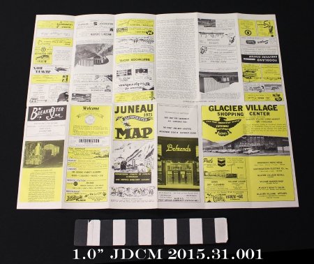
Inside are advertisements for local businesses and information on "points of interest". The very center features three maps: one of the "Greater Juneau Area", one of the "Mendenhall Valley—Auke Bay Area" and one of "Juneau & Douglas Streets". Around the maps is a service directory listing various local stores by type (groceries, hardware, sporting goods, etc.)
Dates of Creation:
1971
People:
Ripley, Rudy J.


