Collection:
Juneau—Douglas City Museum
Object ID:
97.30.001
Accession#:
97.30
Credit Line:
Donated by Rich Poor.
Object Name:
Map
Title:
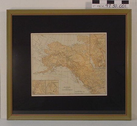
"Alaska & Klondike" Framed Map
Creator:
Servass, R.D.
Date:
1/1/1897 0:00:00
Scope & Content:
Map of Alaska and Klondike region with black mat, glazed and framed. Wood frame 0.75 inches wide, is olive drab with red edging. Map is 10.375 inches by 8.25 inches. Land areas are orange with dark elevations. Printing in black except for transportation and mining trails in red. Irregular shaped insert in upper right corner is enlarged section of Juneau to Klondike. Area is roughly 2.25 inches by 4.75 inches. Two other inserts in lower left corner: left is Dyea and Skaguay routes and right is Klondike river.
Material: Paper/Glass/Wood/Pigment/Ink/Metal/Adhesive
Material: Paper/Glass/Wood/Pigment/Ink/Metal/Adhesive
Dates of Creation:
1/1/1897 0:00:00
Notes:
Skaguay was early spelling of Skagway.
Search Terms:
Map
Mining
Mining

