Collection:
Juneau—Douglas City Museum
Object ID:
87.08.020 AB
Accession#:
87.08
Credit Line:
Donated by Caroline Jensen.
Object Name:
Book & Map
Title:
Book & Yukon Map: Placer Mining — A Handbook For Klondike And Other Miners
Creator:
Colliery Engineer Company, Scranton PA
Date:
1/1/1897 0:00:00
Scope & Content:
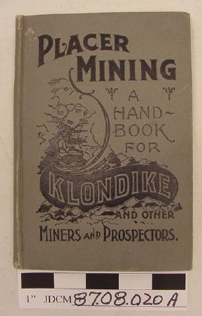
A — 7.75 inches x 5.5 inches x 0.5 inches small hard cover gray book; printing in black. Handwritten in ink on fly leaf "John Peterson, Erma Olson, Carl Jensen." 146 pages.
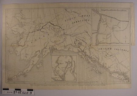
B — Black & white 21.5 inches x 13.875 inches rectangular shaped map showing British Columbia, Alaska and Northwest Territory. Inset in upper right hand corner is enlarged map of Klondike Mining District.
NOTE: Good reference to streams running into 40 Mile River, Birch Creek and 60 Mile Creek.
Inscription: A — "Placer Mining — A Handbook for Klondike and Other Miners and Prospectors"
B — "Colliery Engineer Company's Map of the Yukon Valley showing Routes to the Gold Fields"
Material: Paper/Dye/Textile/Adhesive
Dates of Creation:
1/1/1897 0:00:00
Notes:
Found in basement of old Peterson place.
A: "Placer Mining" — taken off exhibit in the Murray Gallery Permanent Mining Exhibit, Jan 2008.
Not located 11/17/09 BW handwritten note in folder: "Note. Placer Mng HandBook 87.08.20A pulled for mining exhibit 3/1998".
A: "Placer Mining" — taken off exhibit in the Murray Gallery Permanent Mining Exhibit, Jan 2008.
Not located 11/17/09 BW handwritten note in folder: "Note. Placer Mng HandBook 87.08.20A pulled for mining exhibit 3/1998".
Search Terms:
Peterson
Mining
Placer
Management
Mining
Placer
Management


