Collection:
Juneau—Douglas City Museum
Object ID:
85.07.001
Accession#:
85.07
Credit Line:
Museum Purchase.
Object Name:
Map, Relief
Title:
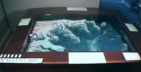
Relief Map Of Juneau in Large Case, lighted
Artist — Creator:
Adkins, Loren, Jr.
Date:
1971
Description:
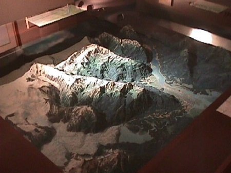
Large topographic relief map in case.
48—inch by 66—inch by approximately 13—inch relief map within walnut cabinet with glass top shows area from Douglas to Auke Bay, including roads, buildings, and airport in detail to scale. Mountains are forested, Gastineau Channel shows tide currents and milkiness of glacial run—off from rivers that enter it. Juneau ice cap shows several small glaciers as well as Mendenhall Glacier. Light system installed in case gives visual effects simulating day's light in August. 24—hour day cycle is repeated every 12 minutes, showing sunrise from east, daylight, sunset to west, and moonlight.
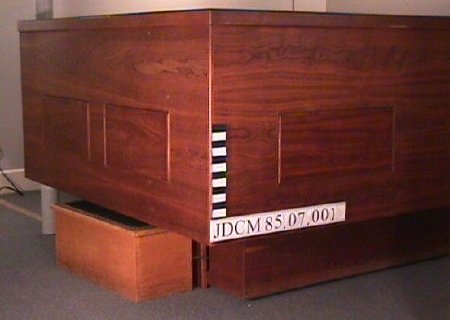
Black walnut case has .25 inch tempered plate glass on top.
Notes:
Map was begun as class project in 1967, & took 4 years to complete. It shows an area of 200 square miles, from Douglas to Auke Bay, as it appeared in 1967. Map is detailed & accurate to scale, which is 4" to the mile. Weight is about 800 lbs.
July 5, 2007 AEF conversation with Tony Shepard
Tony worked on the model with Loren Adkins. The project began their sophomore year in high school as a history class project . They began with a sheet of plywood and make a 1" grid over the entire thing. They drilled holes at each intersection point an cut and inserted hundreds of pieces of heavy steel wire into those holes. The wire was all done to scale. That was as far as they go their sophomore year of high school. In the next step of the project they poured plaster over the wire. Then they used this to make a mold from which the final piece, this object, was cast out of plaster. They took a flight in a small plane and took "over 300 Ektachrome photos" of the area, and they used those photos to do the coloring of the map. It was finished in this form in "about 1966." Loren decided he wanted to send it to Fairbanks for the centennial of the purchase. So he and his dad put a 2" wooden lip around it and fixed sheets of plexiglass to that lip to give it some protection. It was up in Fairbanks in 1967.
Tony helped Loren with some of the basic construction of the piece, but Loren was the artist who did all of the coloration and was the driving force behind the project. He started it in his parents garage. Tony seemed to think that the trees were made from crushed up foam insulation, but remembered that Loren experimented with many different media to make the things on the map.
Tony Shepard, (253)858—2055 Gig Harbor Washington, sheparda@aol.com. There is a card in the document file.
People:
Adkins, Loren
Shepard, Anthony
Shepard, Anthony
Search Terms:
Education
Geological
Map
Glacier
Natural History
Geological
Map
Glacier
Natural History


