Collection:
Juneau—Douglas City Museum
Object ID:
2004.58.007 A—K
Accession#:
2004.58
Credit Line:
Donated by Brian Wallace.
Object Name:
Print, Photographic
Title:
Photograph album of tideland fill, circa 1940
Photographer:
Wallace, Amos
Place:
Juneau
Date:
11/01/1940
Description:
A is album page. B to K are black and white photographs, 4 by 3 inches. All photos horizontally oriented unless otherwise noted.
A — Black paper album page with two holes proper right side. Five photos affixed to front; four photos affixed to back. Captions printed in white ink beside photos to which they refer; "Paul" printed in white ink, lower proper right corner, next to number "6" handwritten in pencil.
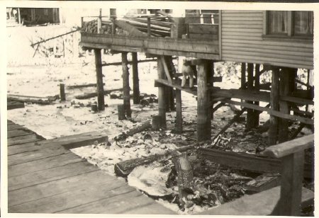
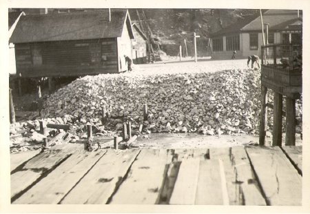
B — Photograph, bottom of house sitting on pilings in upper proper left quadrant. Person visible standing on wooden supports between pilings, bending forward (away from photographer). Boardwalk in lower proper right corner of image. Caption to proper left of photo reads "Collier's Home".
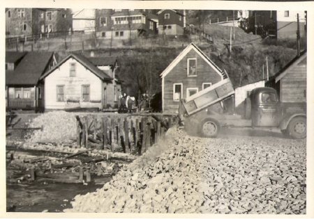
C — Photograph, rock fill clearing sloping downhill toward proper right. Dump truck with tipped bed backed up to top of slope; dust clouds rising from ground behind truck. Two houses clearly visible beyond dump truck, proper left house dark with white trim, proper right house white with dark roof, each with a single second—story window beneath peak of the roof. More houses visible on hillside in background. Caption to proper left of photo reads "Dust".
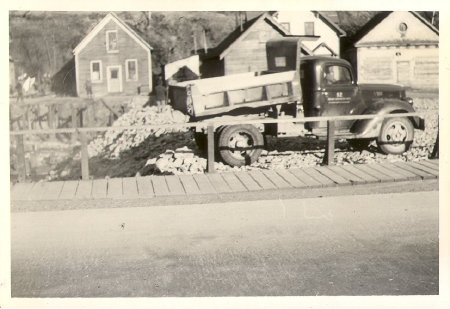
D — Photograph, dump truck facing proper left at edge of rocky slope, separated from photographer by road and wooden boardwalk with railing. Dark house with white trim from previous photo visible in upper proper right quadrant, with three other buildings to proper left of it.
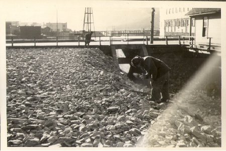
E — Photograph, rock fill sloping downward toward photographer and toward proper left side of photo. Man in foreground facing proper right, bending forward with left hand on leg and right hand extended slightly. Another man in background at railing constructed along road (Willoughby Avenue) that runs parallel to top edge of photo. Some downtown buildings visible in background in upper proper right corner. Two light—colored buildings in upper proper left corner, one on photographer's side of road, one on opposite side. Edge of a mountain (on Douglas Island) faintly visible in distance at top of photo. Caption beneath photo reads "8:00 a.m."
F — Photograph, view of rock fill, photographer is facing the ridge so both lower (original tidal flats) and upper (new height of rock fill) levels can be seen. House on pilings in upper proper right corner; angle is such that rock fill is visible under proper left side of house, with only exposed pilings under proper right side. Federal school building in upper proper left corner of image. One man bending over with shovel at proper left side of ridge top, another bending over at proper left side of house (possibly one more near school building?). Structure on pilings partially visible along proper left edge of photo; boardwalk in foreground. Caption to proper left of photo reads "Church Alley".
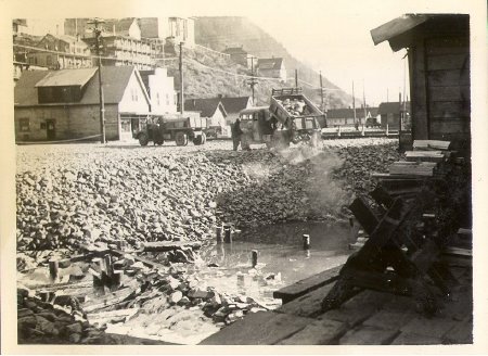
G — Photograph, rock fill sloping down to a pool of water with several sawed—off pilings emerging from it. Dump truck with tipped bed backed up to edge of ridge (hood pointed toward proper right); rocks can be seen sliding out of truck bed and down slope. Dust clouds rising from rocks below truck. Another dump truck facing same direction visible slightly further from photographer than first truck. One man standing next to driver's—side door of each truck. Buildings (Village and beyond), power lines, and mountains visible in upper proper right quadrant. Caption to proper left of photo reads ""It was right where all the tourists could see."" [Caption has quotation marks on page.]
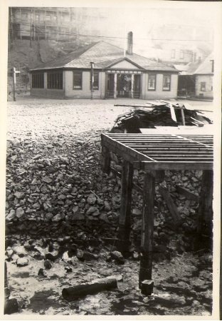
H — Photograph, vertical orientation, wood pilings with open—slatted platform built on top in proper left foreground; directly beyond pilings is rock fill slope with a pile of wood debris partially obscured by platform. Front view of federal school building in central background, with buildings somewhat (due to much fading of photo) visible on hillside behind.
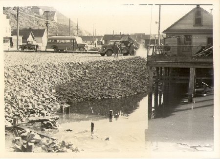
I — Photograph, similar view to G but from slightly different angle. Pool of water with pilings emerging now revealed to be part of a larger body of water, extending under a light—colored house on pilings in upper proper left quadrant. As in G, a dump truck facing proper right is unloading at the edge of the rocky slope; a school bus and truck, both facing proper left, are parked in background. Man standing next to driver's—side door of dump truck.
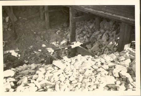
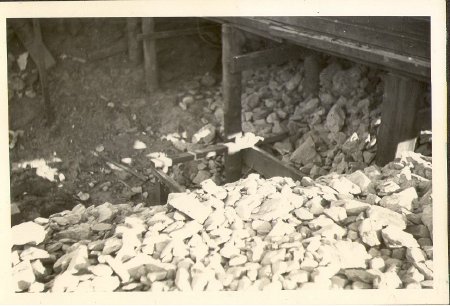
J — Photograph, close—up of rock fill and the bases of several pilings with cross—ties.
K — Photograph, flat expanse of rock fill in bottom half of photo; two light—colored houses on pilings in background. A pile of wood debris including a ladder sits in front of the proper right house. An open—slatted platform on pilings extends in front of this house. Man standing at back corner of proper left house. Caption above photo reads "Platform Removal".
Notes:
B) Mrs. Wilson (nee Collier) was raven, according to Marie Olson. And the house was hers.
D — As per Marie Olson, house in upper proper left corner with round window under peak of the roof is Thunderbird House (people gone). Cecilia's house next door. Marie Olson said that JB Fawcett was the caretaker of the Thunderbird house, but had alcohol problems.
E — As per Marie Olson, light—colored house in upper proper left corner on photographer's side of the road is possibly Clara Wilson's house. (Same as Collier house — married & became a Wilson.)
People:
Wallace, Brian
Wallace, Amos
Wilson, Clara
Fawcett, J.B.
Wallace, Amos
Wilson, Clara
Fawcett, J.B.
Search Terms:
Archival
Photograph
Cityscape
Native
Ethnographic
Tlingit
Auke
Architecture
Transportation
Landscape
School
Federal
Photograph
Cityscape
Native
Ethnographic
Tlingit
Auke
Architecture
Transportation
Landscape
School
Federal
