Collection:
Juneau—Douglas City Museum
Object ID:
2004.58.008 A—H
Accession#:
2004.58
Credit Line:
Donated by Brian Wallace.
Object Name:
Print, Photographic
Title:
Photograph album of tideland fill, circa 1940
Photographer:
Wallace, Amos
Place:
Juneau
Date:
11/01/1940
Description:
A is album page. B to H are black and white photographs. All photos are 4.75 by 3.5 inches and horizontally oriented unless otherwise noted.
A — Black paper album page with two holes proper right side. Three photos affixed to front; four photos affixed to back. Captions printed in white ink beside photos to which they refer; "Paul" printed in white ink, lower proper right corner, next to number "7" handwritten in pencil.
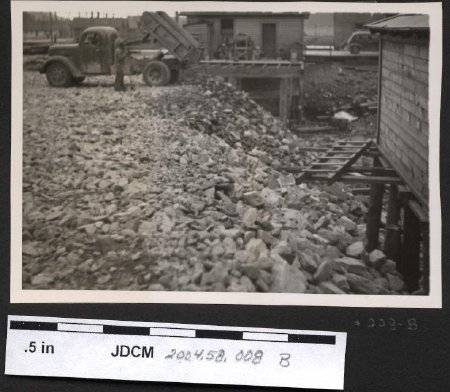
B — Photograph, layer of rock on proper right side of image sloping downward toward proper left. Dump truck with tipped bed in upper proper right corner, backed up to edge of ridge; man standing between truck and photographer. Two houses on pilings visible next to rocky ridge, one in top center of photo, one at proper left edge. A ladder lies on boards extending from the pilings of the proper left house.
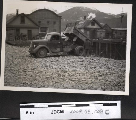
C — Photograph, similar view as B but from different angle. Photographer has moved to his left, so more of dump truck hood and windshield are visible; proper left house is no longer in shot, but other buildings on pilings can now be seen in upper proper left quadrant. Old ANB Hall (large building with curved roof) is partially obscured by house on proper right edge. A man stands near back end of dump truck, facing away from photographer. Mountains on Douglas Island in background.
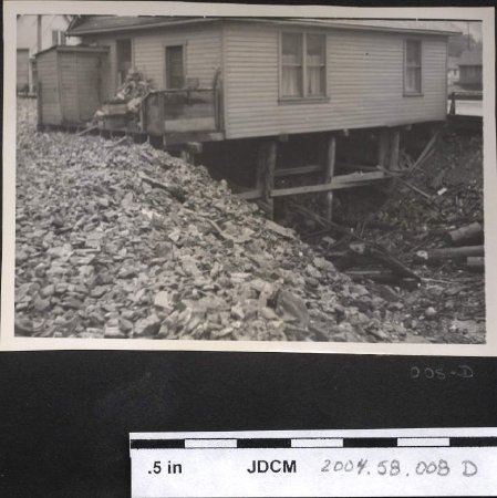
D — Photograph, light—colored single—story house on pilings with small shed/extension attached to proper right end. Many objects on porch of house, white half—curtains in windows. Pile of rock fill in lower proper right quadrant. Pieces of wood pilings and other debris in lower proper left quadrant. Caption to proper left of photo reads "Platform Removal Completed".
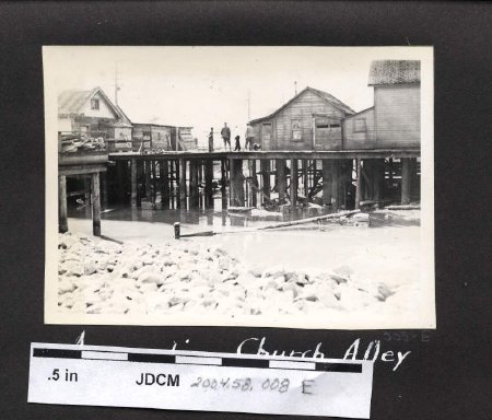
E — Photograph (4.25 by 3 inch), side view of boardwalk on wood pilings. Four people standing together on boardwalk, with approximately four buildings on pilings around them; expanse of water and rock fill in lower third of photo. Caption below photo reads "Approaching Church Alley".
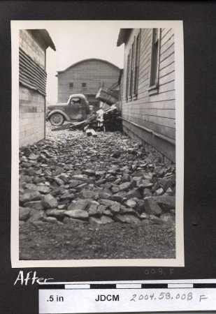
F — Photograph, vertical orientation, view down alley with rock—fill ground between two buildings. Pile of debris and dump truck (facing proper right) with tipped bed at end of alley; behind them is front of old ANB Hall (curved roof). Caption under photo reads "After". [Note: Sequentially, this photograph was taken after G was taken.]
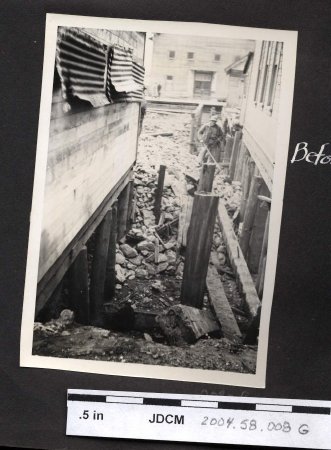
G — Photograph, vertical orientation, similar view to F but taken before ground was filled in. Depicts alley between same two buildings as in F; pilings supporting houses are still visible, as are several more down center of alley. A man in a light—colored hat with hands on hips stands on rocky slope in upper proper left quadrant. Old ANB Hall visible across the road (Willoughby Avenue); two pedestrians are walking down the road in proper left direction. Caption to proper left of photo reads "Before". [Note: Sequentially, this photograph was taken before F was taken.]
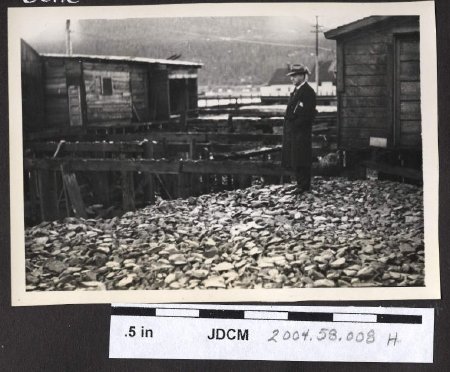
H — Photograph, depicts a man (William L. Paul) in long dark coat and hat standing on rock fill in foreground, facing proper right. A network of connected pilings extends behind him; one building partially visible in upper proper left corner and another at proper right edge, farther from photographer. Mountains on Douglas Island in background. Caption below photo reads "Wm. L. Paul".
Notes:
C — As per Marie Olson, house on proper right edge is Collier house. [Also, note about ANB Hall: building was originally on Douglas Island, then floated over to Juneau side.]
D — As per Marie Olson, house in photo is Collier/Wilson house.
D — As per Marie Olson, house in photo is Collier/Wilson house.
People:
Wallace, Amos
Wallace, Brian
Paul, William L.
Collier
Wallace, Brian
Paul, William L.
Collier
Search Terms:
Archival
Photograph
Cityscape
Native
Ethnographic
Tlingit
Auke
Architecture
Transportation
ANB
Landscape
Photograph
Cityscape
Native
Ethnographic
Tlingit
Auke
Architecture
Transportation
ANB
Landscape
