Collection:
Juneau—Douglas City Museum
Object ID:
2006.11.233
Accession#:
2006.11
Credit Line:
Donated by the Caroline Jensen Estate.
Object Name:
Map
Title:
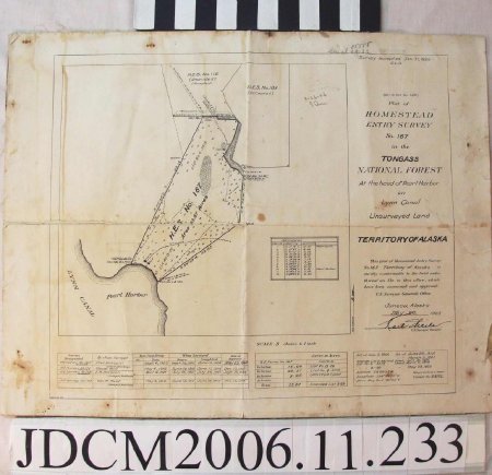
Plat of HOMESTEAD ENTRY SURVEY No. 167 in the TONGASS NATIONAL FOREST At the head of Pearl Harbor on Lynn Canal
Date:
January 30, 1926
Scope & Content:
The map is printed on a canvas—like surface, threads are fraying around the edges. The map is of the plat of homestead entry survey number 167. There is text along the proper left side that reads "Survey accepted Jan 30, 1926, G.L.O. (New Series No. 1466) Plat of HOMESTEAD ENTRY SURVEY No. 167 in the TONGASS NATIONAL FOREST At the head of Pearl Harbor on Lynn Canal Unsurveyed Land, TERRITORY OF ALASKA, This plat of Homestead Entry Survey No. 167 Territory of Alaska is strictly conformable to the field notes thereof on file in this office, which have been examined and approved. U.S. General's Office, Juneau Alaska May 20, 1925 [illegible signature], U.S. Surveyor General.
Boxes along the bottom contain information about the surveyors. The first box, on the proper right, lists who conducted what surveys and when. The second box, to the proper left of the first charts the area of the various properties surveyed. The last box on the proper left contains dates for the map as well as legend information, such as the latitude and longitude.
Boxes along the bottom contain information about the surveyors. The first box, on the proper right, lists who conducted what surveys and when. The second box, to the proper left of the first charts the area of the various properties surveyed. The last box on the proper left contains dates for the map as well as legend information, such as the latitude and longitude.
Dates of Creation:
Survey accepted January 30, 1926
Signed by U.S. Surveyor General on May 20, 1925
Signed by U.S. Surveyor General on May 20, 1925
People:
Jensen, Caroline
Search Terms:
Homesteading
Government
Federal
Government
Federal
