Collection:
Juneau—Douglas City Museum
Object ID:
2006.11.041
Accession#:
2006.11
Credit Line:
Donated by the Caroline Jensen Estate.
Object Name:
Map
Title:
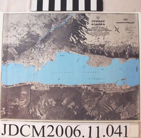
A aerial photograph map of Juneau and Douglas
Creator:
State of Alaska Dept. of Highways Planning and Research Division
Date:
1969
Year Range from:
1969
Scope & Content:
An aerial map of Juneau and Douglas dated from 1969. It is an amalgamation of several aerial photographs of varying degrees of focus stitched together and made into a very large map that expands from Norway Point to the left to Old Treadwell Road to the right. There are labels that mark prominent natural as well as artificial (man—made) sites and roadways. Near the top righthand corner is a very large label, "City of Juneau, Prepared by the State of Alaska Department of Highway Planning and Research Division, in cooperation with U.S. Department of Transportation Federal Highway Administration Bureau of Public Roads" there is also a compass direction of north, the year, "1969", a scale of feet and the label, "Semi controlled aerial mosaic based on photography flown May 1968. Map field checked 1969."
Dates of Creation:
1969
People:
Jensen, Caroline
Search Terms:
map
