Collection:
Juneau—Douglas City Museum
Object ID:
2003.26.003
Accession#:
2003.26
Credit Line:
Transferred from the City and Borough of Juneau Engineering Department.
Object Name:
Map
Title:
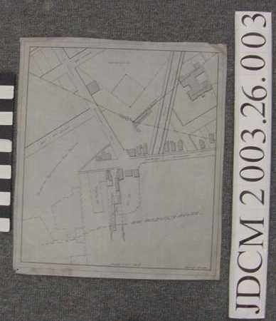
1935 Metcalf Map of Willoughby ave on Tracing Cloth
Creator:
Metcalf, Frank
Date:
6/1/1935
Scope & Content:
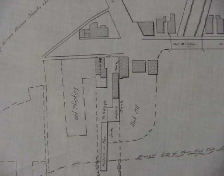
Roughly square map of Willoughby Avenue June 1935 by City Engineer Frank Metcalf. Gold Creek is shown with new bridge, parts of 8th and 9th St shown, baseball grounds included and several buildings indicated with diagonal hatching. Native Hospital , Grandstand and House Number 8 are only ones labeled. Rock fill, junk, piling and "Planked area supporting various houses — shacks etc" written on map. "Willoughby & Glacier" written on reverse, various numbered codes in red and blue pencil and marker at edges.
Material: Textile/Ink/Plant
Material: Textile/Ink/Plant
Dates of Creation:
6/1/1935 0:00:00
Notes:
Tracing cloth, often called "linen" is typicaly heavily starched & stiffly calendared cotton. Frank Metcalf was City's 1st licensed engineer.
Baseball field was where Federal Bldg is now & Native Hospital was located where Federal parking lot is located.
Baseball field was where Federal Bldg is now & Native Hospital was located where Federal parking lot is located.
Search Terms:
Map
Territorial
City
Architecture
Territorial
City
Architecture

